


Voting District 0053, Montgomery County, Texas
About
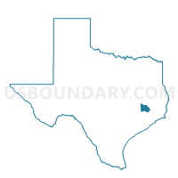
Outline

Summary
| Unique Area Identifier | 675922 |
| Name | Voting District 0053 |
| County | Montgomery County |
| State | Texas |
| Area (square miles) | 14.16 |
| Land Area (square miles) | 14.13 |
| Water Area (square miles) | 0.03 |
| % of Land Area | 99.81 |
| % of Water Area | 0.19 |
| Latitude of the Internal Point | 30.16956480 |
| Longtitude of the Internal Point | -95.15311020 |
Maps


Graphs
Select a template below for downloading or customizing gragh for Voting District 0053, Montgomery County, Texas


Neighbors
Neighoring Voting District (by Name) Neighboring Voting District on the Map
- Voting District 0007, Montgomery County, TX
- Voting District 0016, Montgomery County, TX
- Voting District 0023, Liberty County, TX
- Voting District 0026, Montgomery County, TX
- Voting District 0041, Montgomery County, TX
- Voting District 0052, Montgomery County, TX
- Voting District 0054, Montgomery County, TX
- Voting District 0636, Harris County, TX
Top 10 Neighboring County Subdivision (by Population) Neighboring County Subdivision on the Map
- Southeast Montgomery CCD, Montgomery County, TX (318,202)
- Northeast Harris CCD, Harris County, TX (59,937)
- Cleveland CCD, Liberty County, TX (25,460)
Top 10 Neighboring Place (by Population) Neighboring Place on the Map
- Patton Village city, TX (1,557)
- Roman Forest town, TX (1,538)
- Woodbranch city, TX (1,282)
- Plum Grove city, TX (600)
Top 10 Neighboring Unified School District (by Population) Neighboring Unified School District on the Map
- New Caney Independent School District, TX (50,152)
- Cleveland Independent School District, TX (19,836)
- Huffman Independent School District, TX (14,985)
- Splendora Independent School District, TX (14,308)
Top 10 Neighboring State Legislative District Lower Chamber (by Population) Neighboring State Legislative District Lower Chamber on the Map
- State House District 16, TX (203,299)
- State House District 127, TX (187,102)
- State House District 18, TX (150,998)
Top 10 Neighboring State Legislative District Upper Chamber (by Population) Neighboring State Legislative District Upper Chamber on the Map
Top 10 Neighboring 111th Congressional District (by Population) Neighboring 111th Congressional District on the Map
Top 10 Neighboring Census Tract (by Population) Neighboring Census Tract on the Map
- Census Tract 6926.02, Montgomery County, TX (10,150)
- Census Tract 7003, Liberty County, TX (9,514)
- Census Tract 6928.01, Montgomery County, TX (8,647)
- Census Tract 6925, Montgomery County, TX (8,331)
- Census Tract 6927, Montgomery County, TX (7,058)
- Census Tract 2516, Harris County, TX (5,750)
- Census Tract 6928.02, Montgomery County, TX (3,745)